Following the death of Charles I, the last Emperor of Austria and King of Hungary, on 1 April 1922, his family remained in exile, yet never became detached from the idea of the Austro–Hungarian Monarchy – or of a Central European polity capable of taking its place. Empress Zita and her circle continued to regard Otto as someone who might one day play a part in holding the peoples of the region together. For them, the Habsburg Empire was not merely a closed chapter of the past, but a lost political and cultural framework that could still be reimagined.
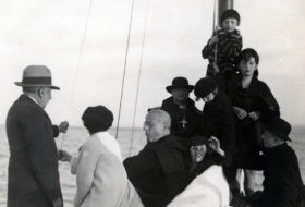
In the 1920s, during his secondary-school years, the Crown Prince received numerous visitors in Lequeitio from across the lands once belonging to the empire: scouts, sports teams, and pilgrim groups. These encounters also indicated that the displaced ruling family had not lost contact with its former subjects and supporters.
But how had they come to this remote corner of Spain? After Charles’s passing, his widow and those who had joined him during his forced stay on the island were allowed to leave Madeira. The pregnant Zita and her children were offered refuge by her relative, King Alfonso XIII of Spain: first at the royal hunting lodge of El Pardo near Madrid, and later in the Basque fishing village of Lequeitio. The Uribarren Palace, situated by the ocean, was originally intended merely as a summer residence but ultimately became a permanent dwelling and a true home.[1] They lived there until 1929, when the older children began preparing for university.
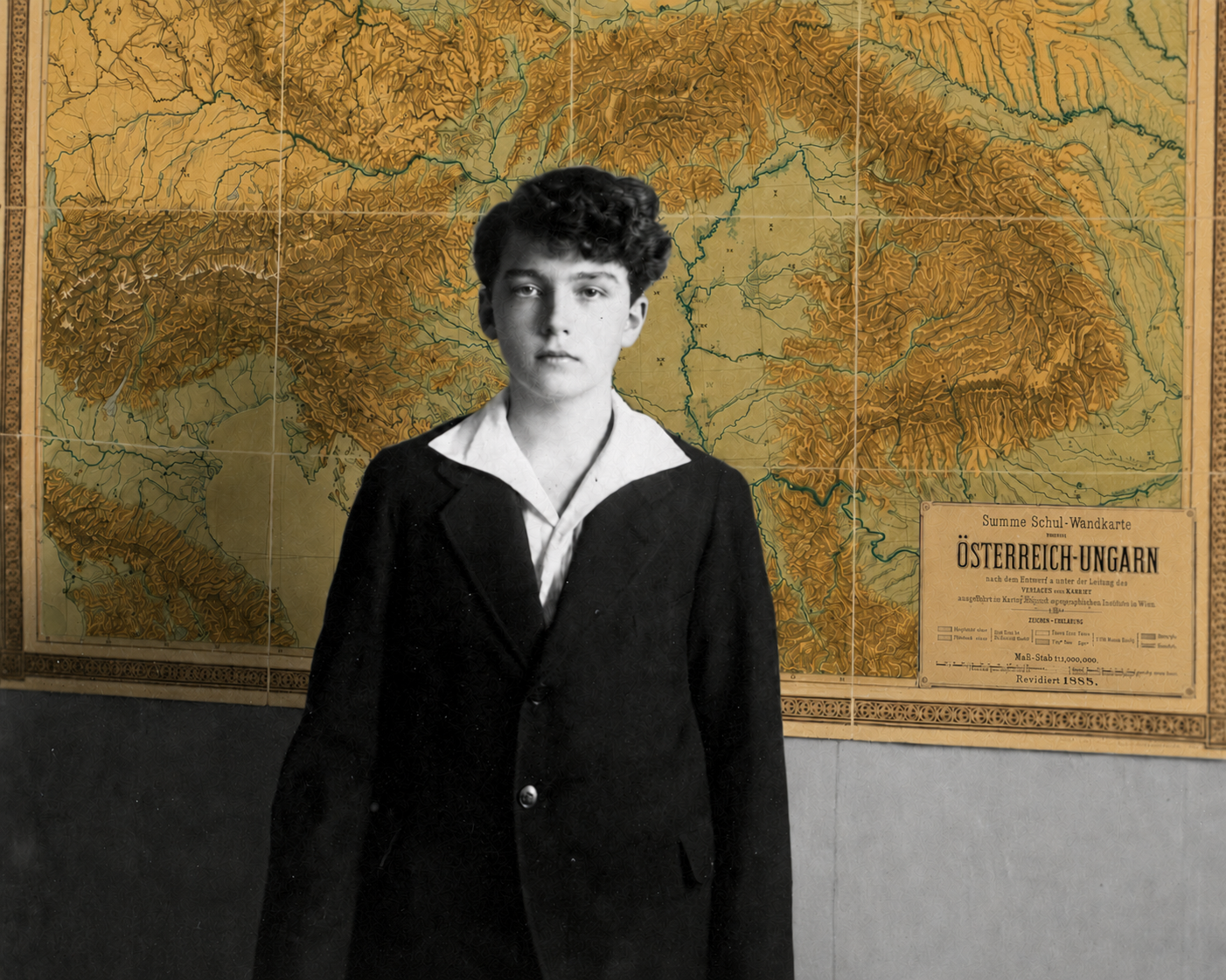
Otto’s studies followed a carefully designed Austro-Hungarian curriculum, supervised by a committee led by the former ministers of education Max Hussarek and János Zichy. Among his teachers were Benedictines from Pannonhalma, while Count Heinrich Degenfeld-Schonburg acted as his personal tutor.
The expectation was not simply that Otto should acquire a modern, civic education. Empress Zita continued to reckon with the possibility of a restoration and considered her eldest son’s fitness for the role of sovereign paramount. The syllabus, languages, history, geography, and daily discipline were all directed towards this end.
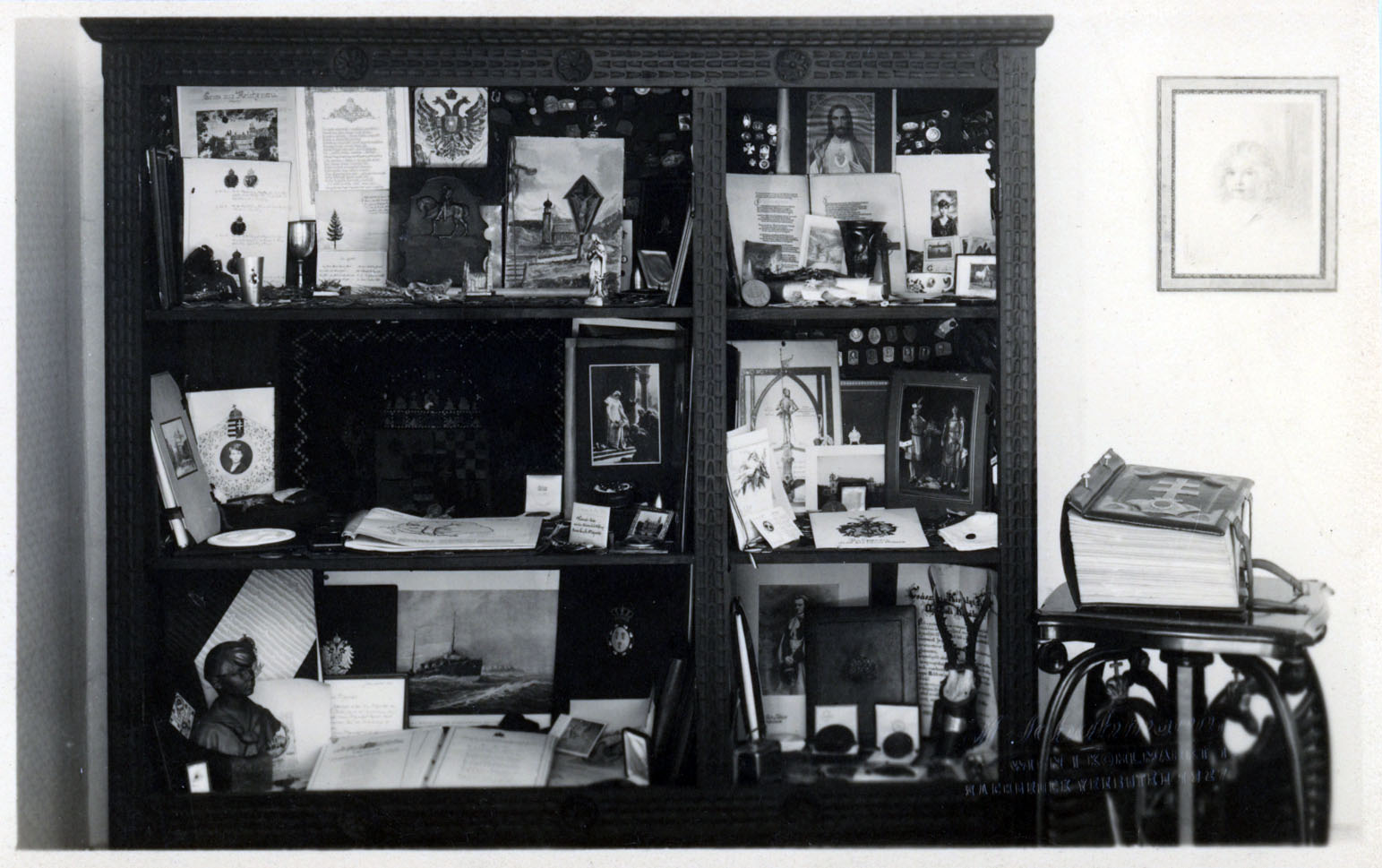
This outlook was reflected not only in the structure of his instruction but also in the objects surrounding them. In the reception room, a collection displayed in a glass cabinet made this inheritance visible to visitors. We know about these items from the description provided by Hans Karl Zessner-Spitzenberg, a prominent figure in the Austrian legitimist movement. The representative collection included military decorations from various Austro-Hungarian regiments, coin collections, autograph albums, photograph albums, goblets, as well as soil from Austria and Hungary.[2]
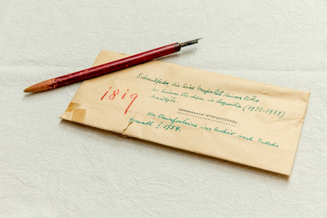
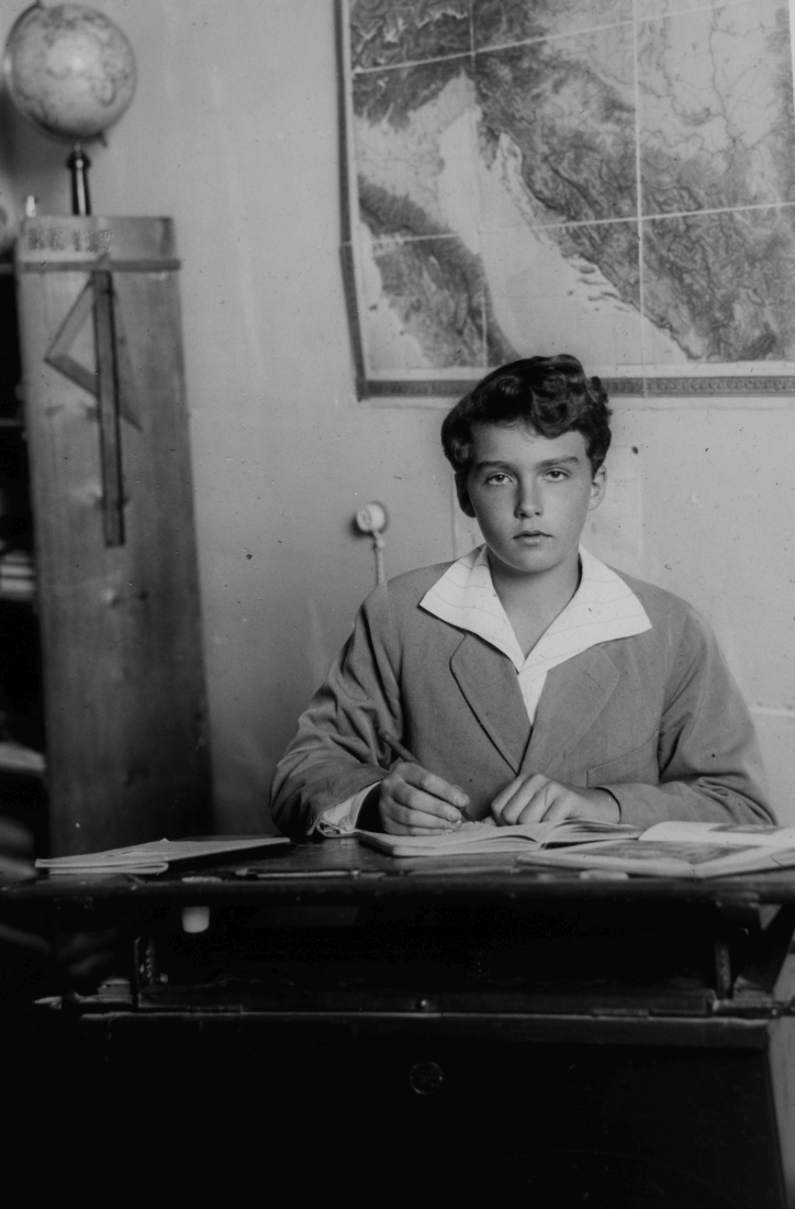
The schoolroom was furnished in accordance with the same principles. Some of the photographs taken in Lequeitio show Otto during lessons. These images reveal that the room overlooking the ocean contained a teacher’s table, a pupil’s desk, a blackboard, and a cupboard reserved for textbooks. Among the teaching aids, our Foundation’s collection also preserves the writing implement used by the Crown Prince in Lequeitio: a worn steel dip pen with a wooden handle.[3]
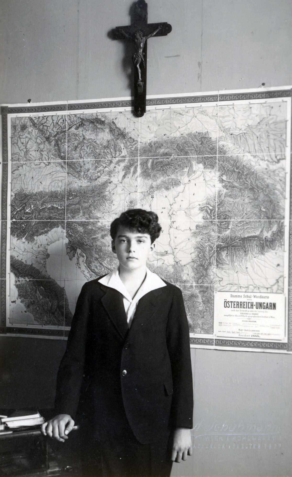
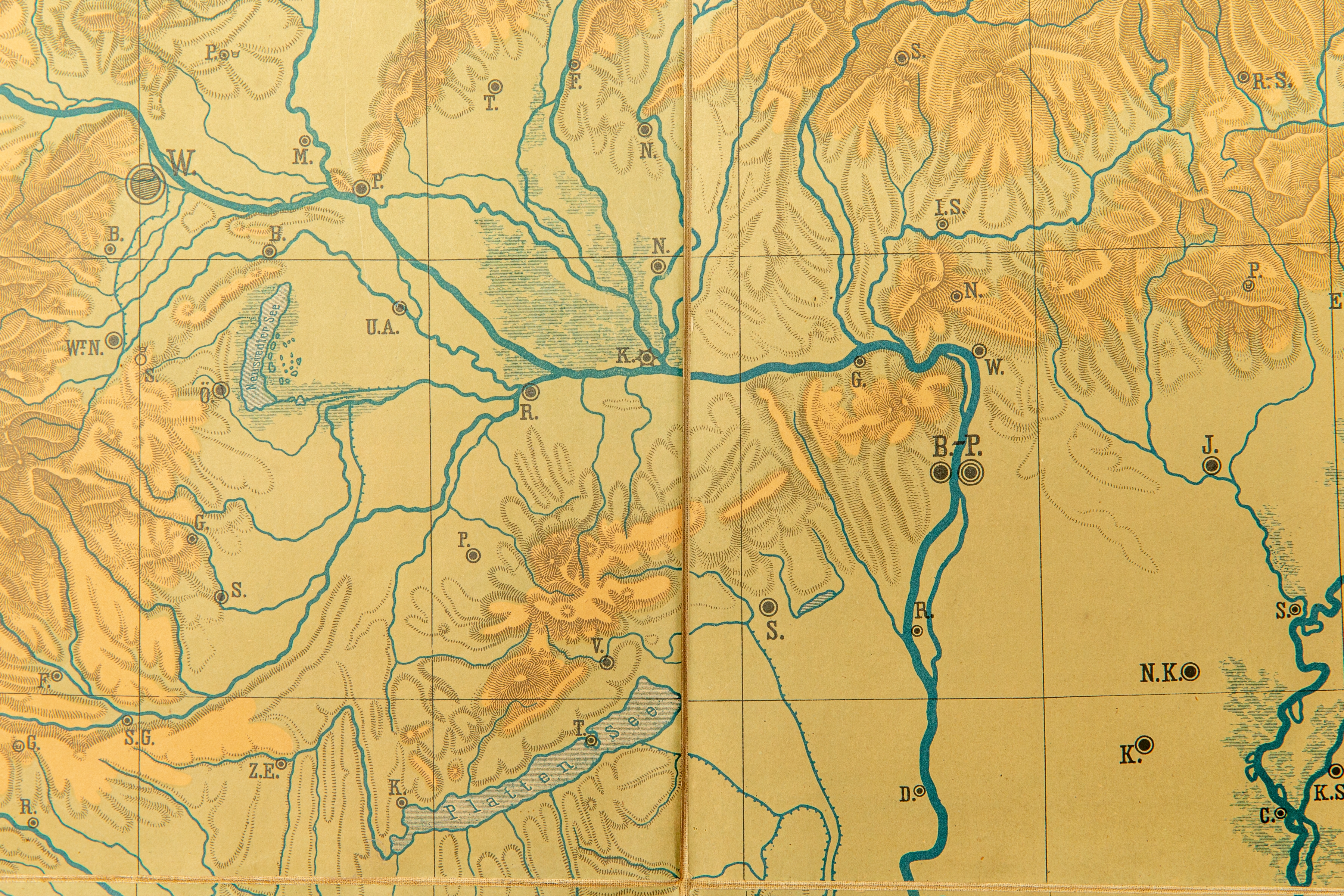
The photographs also show a globe and, in a central position, the crucifix which, according to the records, had once belonged to Charles I. Beneath the cross hung a relief map of the Austro-Hungarian Monarchy. Zessner also mentioned this object in his memoirs, published in 1931: “On the front wall of the room hung a large orographical map of the lands of the Austro-Hungarian Monarchy, which, without any political borders being marked, showed with particular clarity – solely through the course of the mountains and valleys and the position of the plains – the geographical and therefore also cultural cohesion of the Eastern Alpine, Sudeten, Carpathian, and Karst lands.”[4] Thus, rather than depicting the political borders fixed by the peace treaties following the First World War, the map presented the region as a coherent geographical and cultural whole. For Otto, too, it pointed to a clear mission: to rise above current political realities and once again bring together the peoples of Central Europe.
The contemporary diaries in our Foundation’s care, which document the children’s everyday lives, reveal that on 1 December 1922, during a combined geography and German lesson, the pupils had to collect from a map booklet the towns of the former Monarchy beginning with the letters “A”, “B”, or “C”.[5] Behind the game lay the intention that they should become familiar, in geographical terms as well, with the lands of the old state.
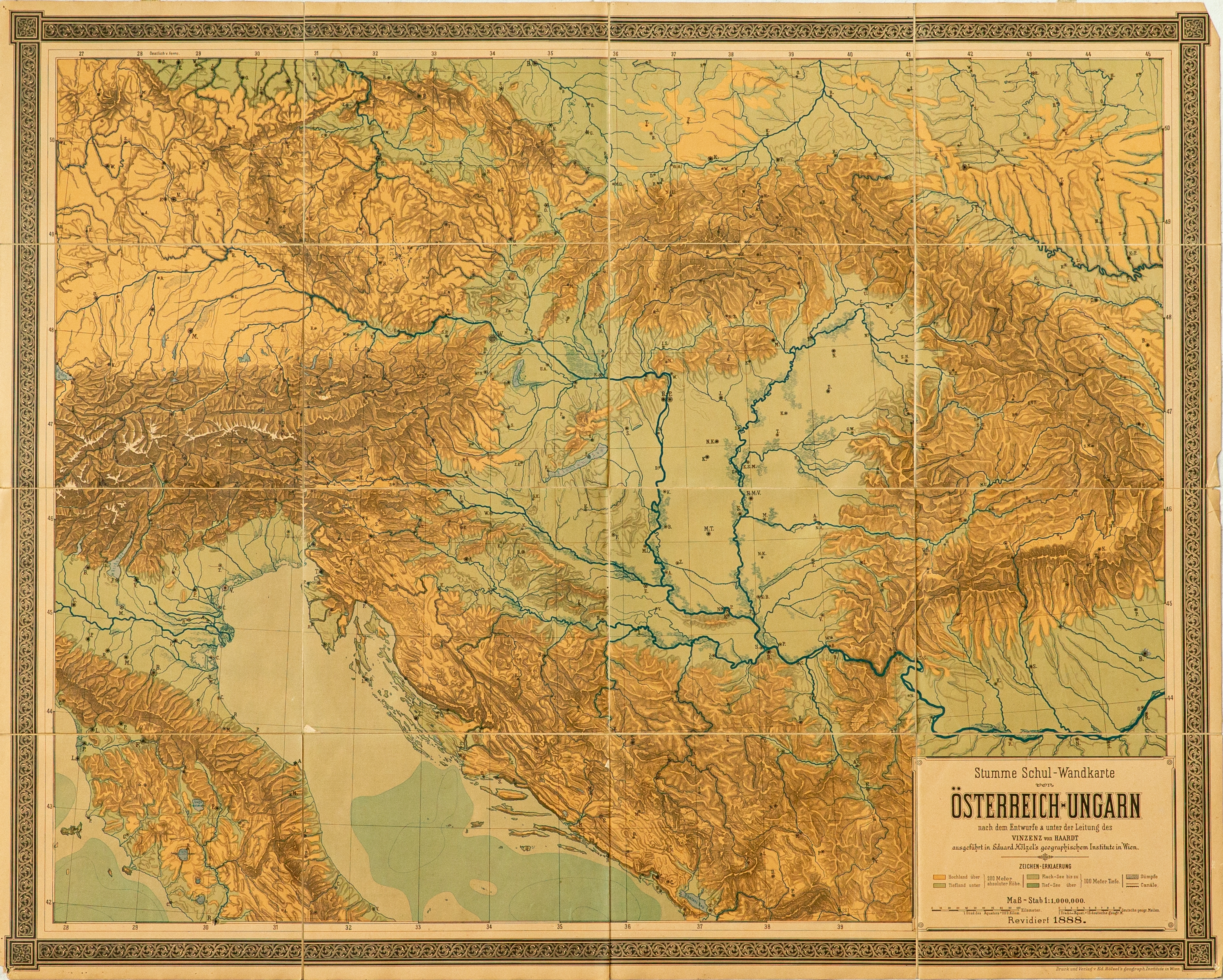
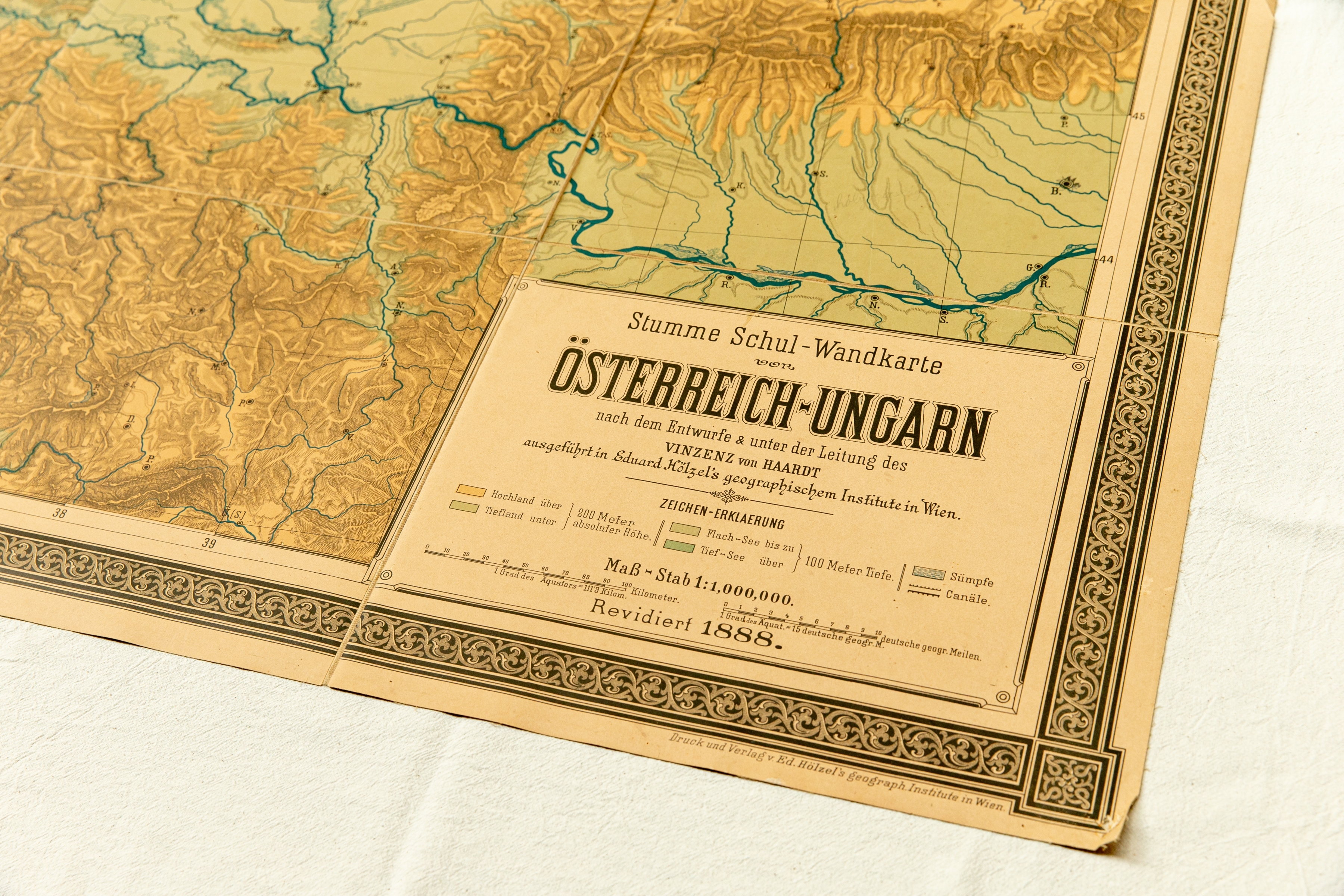
Our collection has recently been enriched by part of Heinrich Degenfeld-Schonburg’s estate connected to the family, and above all to Otto von Habsburg. The material, currently under archival processing, includes the wall map that once hung in the schoolroom. Measuring 144 cm in width and 114 cm in height, it consists of 16 small printed sheets mounted on gauze; its scale is 1:1,000,000. On the relief representation, framed by a tendril-patterned border, only the initial letters of the towns’ names are indicated. An inscription appears in the lower right-hand corner: “Stumme Schul-Wandkarte von Österreich-Ungarn.” Eduard Hölzel’s Geographical Institute in Vienna printed maps and textbooks specifically for school geography teaching. This copy dates from 1888, suggesting that it may already have been in the possession of the royal family. There is a single pencil mark on its surface – at Bucharest.
Taken together, the objects from the schoolroom, the diaries, and the surviving wall map show how strongly the Monarchy, although deprived of political reality, and the idea of Central European unity interpreted through it, remained present in the lives of the Habsburg children growing up in exile. The deep conviction that took shape in Otto von Habsburg’s childhood would later reappear, for example, in his 1952 speech in Paris: “If we cast even a single glance at the map, we can see that the Danubian polity was by no means the artificial creation of an ambitious dynasty, but a political, military, and economic reality.”[6]
“Otto was closer to the homeland – to the former Austro-Hungarian Monarchy, and to the lives and problems of its people – than one might have supposed.” [7]
Beáta Vitos-Merza
Péter Matolcsi [8]
[1] Pérez-Maura, Ramón: Del Imperio a La Unión Europea. La huella de Otto de Habsburgo en el siglo XX. Madrid, Rialp, 1997, 101–112.
[2] Zessner-Spitzenberg, Hans Karl: Otto von Österreich. Seine Kindheit und Jugend, sein Bildungsgang. (Dem Andenken an Karl von Österreich Gedächtnisjahrbuch 3.) Wien, Tyrolia A. G., 1931, 44.
[3] The object was wrapped in an envelope on which it was carefully recorded that it had been used by Otto von Habsburg in Lequeitio between 1922 and 1929.
[4] „An der Stirnwand des Zimmers hing eine große orographische Karte der Länder der österreichisch-ungarischen Monarchie, die so recht deutlich, ganz ohne Einzeichnung der politischen Grenzen, rein nur durch den Zug der Gebirge und der Täler und die Lage der Ebenen die geographische und daher auch kulturelle Zusammenhörigkeit der Ostalpen-, Sudeten-, Karpathen- und Karstländer zeigt.” Zessner-Spitzenberg: Otto von Österreich, 48–49.
[5] HOAL I-1-d-81 143.
[6] Fejérdy, Gergely: Otto von Habsburg’s concept of Europe (1952) – Thoughts on Europe that are Still Relevant
[7] Csonka, Emil: Habsburg Ottó. Egy különös sors története. Munich, Új Európa, 1972, 56.
[8] This article was made possible by professional support from the EKÖP-25 University Research Scholarship Programme of the Ministry of Culture and Innovation, financed from the National Research, Development, and Innovation Fund.